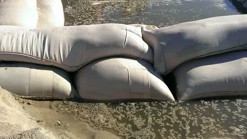
The City of Saint John will open an emergency sandbag distribution centre starting on Monday.
Saint John EMO made the announcement Sunday as water levels are forecast to reach 5.2 metres on Friday.
The measure is part of the city’s new Spring Freshet Emergency Response Policy recently presented to council.
Once water levels are forecast to reach 5.2 metres, Saint John EMO will implement a flood emergency response, which includes establishing sandbag distribution centres.
The centre will be located at the municipal salt storage building at 406 Bay Street. It will be open from 8 a.m. to 6 p.m. daily.
Residents will have to present a photo ID with a city address and load the sandbags into their vehicle.
In Rothesay, sandbags are available at Brookvile Lime and there is sand next to Rothesay Arena.
Quispamsis has a sandbag-filling station at the qplex parking lot starting at 8 a.m. Monday.
In Grand Bay-Westfield, you can get sandbags at the back of town hall from 9 a.m. to 5 p.m. and sand at the Keel Pit beginning at 10 a.m. Monday.
Dozens of sand and sandbag locations have been set up throughout the province. You can find an updated list of locations online.
Visit https://t.co/uy5VwpGNBS for more information. #SJEMO #riverwatch2019 pic.twitter.com/UxBLUNHaKu
— City of Saint John (@cityofsaintjohn) April 21, 2019
Water levels in the Saint John area are expected to exceed flood stage of 4.2 metres by Monday morning.
The latest five-day forecast says levels will hit 4.5 metres on Tuesday, 4.8 metres on Wednesday, 5.1 metres on Thursday and 5.2 metres on Friday. Water levels peaked at 5.73 metres during the 2018 flood.
Fredericton passed flood stage on Saturday and is expected to reach 8.1 metres by Monday morning. Water levels are expected to fall to 7.0 metres by Friday.
Maugerville, Jemseg, Sheffield and Lakeville Corner have also exceeded flood stage. Grand Lake is forecast to surpass flood stage by Monday morning.
Call 511 for road closures and conditions. Check online at https://t.co/7zkPP4sIUE or follow @brunswick511. You can also download the app, which can send you alerts about the roads you need to want to know about. Just search for 511 New Brunswick in your app store. pic.twitter.com/KzkUWKPBtW
— NBEMO / OMUNB (@NBEMO_OMUNB) April 21, 2019
The province says more than 40 roads have been impacted by flooding so far, including 25 road closures. A list of the latest road closures is available online.
Officials say it is an offence to ignore or move any barricades which are in place. Drivers are being told to avoid any roads covered by water as there could be unseen sinkholes or other damage and debris.
The province is also reminding drivers to watch for wildlife on roads as the rising water levels will force some animals to seek higher ground.


