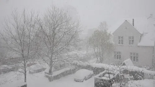
Saint John police are asking motorists to stay off the roads as a winter storm bring heavy snow and strong winds to southern New Brunswick.
Sgt. Steve Wilson says they have dealt with a handful of collisions so far Monday, but most people appear to be slowing down or staying home.
The City of Saint John says crews are doing their best to keep main streets, highway connections and emergency routes open.
The travel-not-recommended advisory has been lifted on Highway 1, but it remains in place on the Trans-Canada Highway from Longs Creek to Nova Scotia due to poor visibility.
You can find the latest road conditions by visiting NB 511’s website or by calling 511.
It seems many people are taking the advice of police and staying put this afternoon. King Street in uptown #SaintJohn, which is usually very busy at this time of day, has very few vehicles on it. #nbstorm pic.twitter.com/uPBopokmK9
— Brad Perry (@BradMPerry) March 4, 2019
Jean-Marc Couturier, a meteorologist with Environment Canada, says between 30 and 40 centimetres of snow is expected in places like Saint John, the Kennebecasis Valley and Sussex.
“The snow will intensify throughout the morning, with good accumulation rates continuing right through the afternoon,” said Couturier.
Communities from Fredericton to Grand Lake, which are under a snowfall warning, will see 15 to 25 centimetres of snow; northern New Brunswick is expecting between five and 15 centimetres.
Winds will increase to around 60 kilometres per hour, which will cause blowing snow and reduced visibility.
We are advising motorists to please stay off the roads. Road conditions are extremely poor. Consider postponing all non-essential travel. pic.twitter.com/JIBFT8qCT4
— Saint John Police (@saintjohnpolice) March 4, 2019
There are many closures and cancellations due to the storm, including Saint John Transit, which cancelled services at 10:30 a.m. Monday.
Saint John has also issued a temporary overnight parking ban for the north, east and west parts of the city to help with snow removal.
Couturier said the precipitation should begin to taper off by around the supper hour.
“It looks like definitely by early evening, we would have the back edge of precipitation out of our way and then the snow clearing and recovery can go on through the evening hours,” he said.
Environment Canada is forecasting a fair bit of sunshine for the rest of the week, but daytime highs will be on the cold side.


